Choose a route and discover the Krkonoše Mountains on cross-country skis

The old road along the telegraph poles
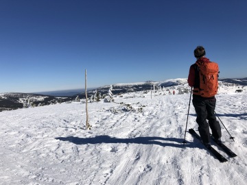
The route begins at the Česká hospoda restaurant and leads towards Svatý Petr along the Dolský stream. Once you see the Svatý Petr cable car, turn right and continue to the Hromovka cottage. From there, the trail climbs up to a lookout point offering a beautiful view of the Elbe Dam. Continue along the trail marked by old telegraph poles, which will take you to Přední Planina.
Tip: If you decide to take this route in the evening, watch out for snow groomers on the way down!
Route length: 4,6km
Elevation gain: 442m
Link to map: HERE
Goat Ridges - Luční Bouda - Přední Planina
The route begins above the primary school in Špindlerův Mlýn at the Biskupská vyhlídka shelter. From there, the trail heads around the Horal mountain hotel, opposite which is one of the steepest slopes in Špindlerův Mlýn – STOH. The route then climbs steeply over Kozí hřbety along the old Bucharova trail to Luční bouda.
From Luční bouda, continue towards Luční hora, from where a short but picturesque descent to the Výrovka cottage awaits you. From there, the trail continues to Rozcestí, where you head towards Klínové boudy and then arrive at Přední Planina.
Tip: Bring avalanche equipment!
Route length: 15,6km
Elevation gain: 773m
Link to map: HERE
Peter's Hut
Trasa začíná na parkovišti Medvědín a vede směrem k Dívčím lávkám, kde je potřeba přejít silnici. Po zhruba 200 metrech začíná stoupání k Davidovým boudám. U nich se traverzuje sjezdovka a dále se pokračuje vzhůru podél sjezdovky až k Vosecké a Moravské boudě, kde si můžete dopřát příjemné občerstvení.
Odtud trasa stoupá směrem k Petrovce, u které se odbočí doleva a pokračuje k vyhlídce Ptačí kámen. Z této vyhlídky vás čeká příjemný a zábavný sjezd zpět na Dívčí lávky.
Tip: Od Ptačího kamene je trasa docela úzká, ale zábavná a to hlavně večer.
Route length: 12,4km
Elevation gain: 559m
Link to map: HERE
Labská Chalet - Zlaté návrší - Medvědín
The route starts at the Medvědín car park and from there it follows the Elbe River, where you will be surrounded by beautiful nature. A large part of the route follows the ‘Buď fit’ cross-country ski trail, which ends after 4.5 km. Then you continue through unspoilt nature, where the impressive scenery of the Elbe Valley opens up on your left.
At the end, a more demanding section awaits you – the last kilometre covers more than 200 metres in altitude, at the end of which you will see the Labská bouda chalet. From here, the route continues towards the Mohyla Hanče a Vrbaty memorial (don't forget to stop at the frozen Labský waterfall). After the memorial, you will arrive at Vrbatova bouda, from where the path leads only downhill.
On the way, we recommend turning off to Šmídova vyhlídka, which offers magnificent views.
Tip: If there is a lot of snow, be sure to take avalanche equipment with you!
Route length: 13,9km
Elevation gain: 700m
Link to map: HERE
Full-day trip
The route starts at the Dolní Mísečky car park (if there is not enough snow, we recommend using the car park at Horní Mísečky). From Dolní Mísečky, where there is convenient free parking, head towards Horní Mísečky. Here you will join the Old Carriage Road, which will take you to Zlaté návrší.
From Zlaté návrší, continue to the U čtyř pánů crossroads. After less than 200 metres, you can take off your skis and enjoy a short but beautiful descent to Krakonošova snídaně. From here, you will need to put your skis back on and continue to the Ručičky crossroads.
From here, the climb begins across the Rokytnice ski slopes to Dvoračky, where you can enjoy some pleasant refreshments. The trail then leads up above Kotelní jámy, around Harrachovy kameny, and finally takes you back to Zlaté návrší.
Tip: Bring plenty of food and drink with you! We recommend a roll and soup at the Dvoračky cottage.

